®
SHIPSPOTTING.COM
WELCOME TO SHIPSPOTTING.COM
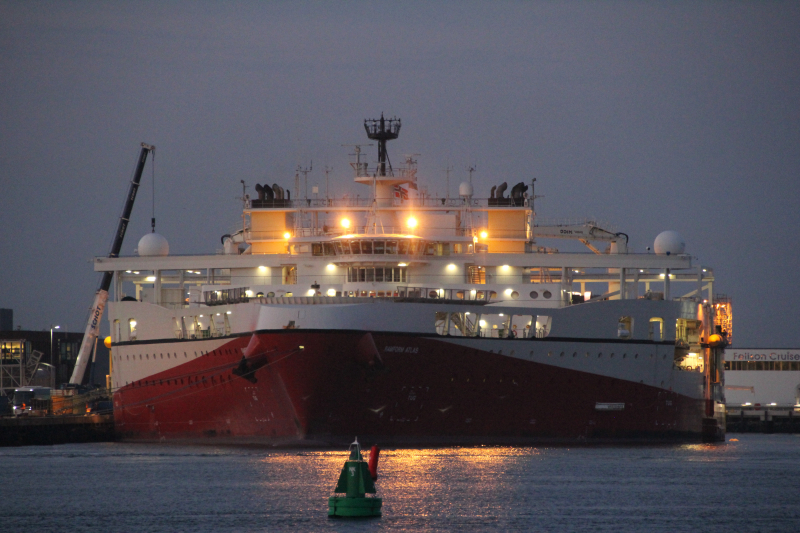
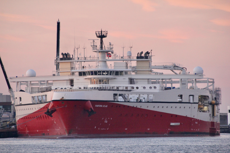
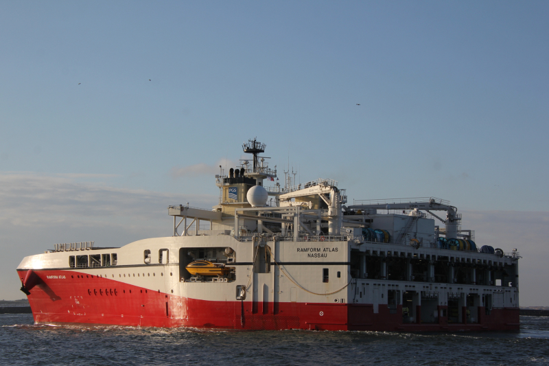
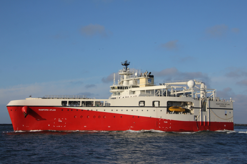
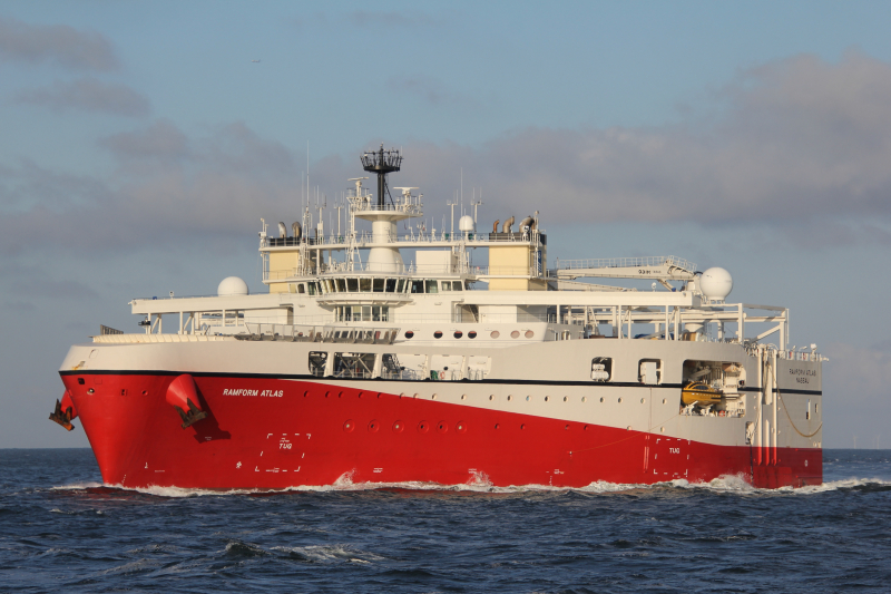
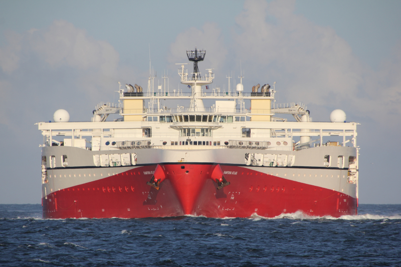
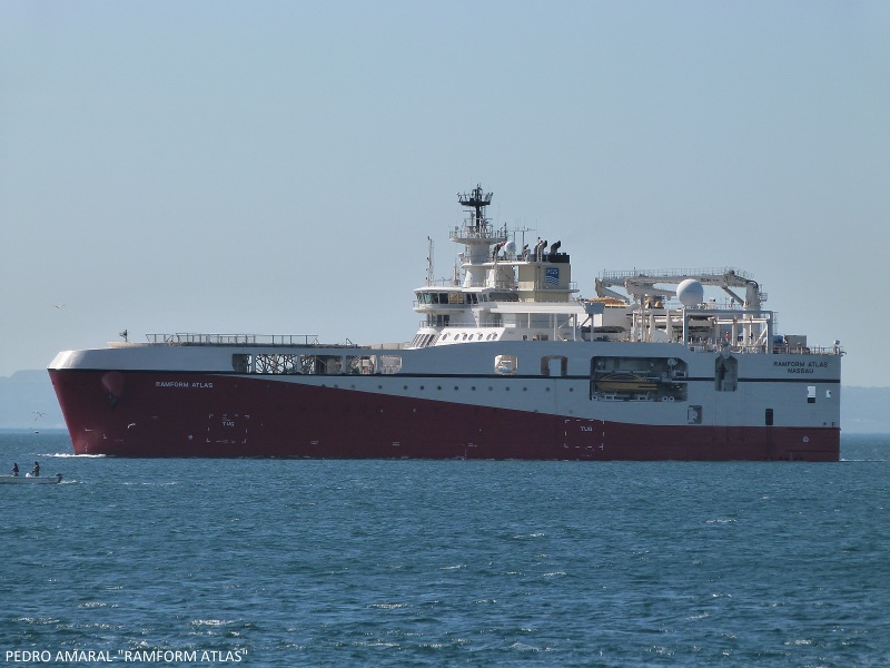
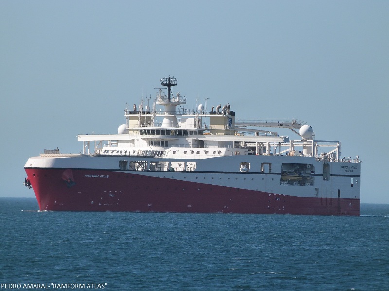
RAMFORM ATLAS - IMO 9629897

Photo
details
Photographer:Alf K [ View profile ]
Captured:Mar 21, 2014
Title:Ramform Atlas
Photo Category:Research And Survey Vessels
Added:Mar 21, 2014
Views:7,114
Image Resolution:1,152 x 768
Description:
Leaving Bergen.
More of Ramform Atlas: http://www.fotoalfi.com/skip/r/ramform-atlas.html
Vessel
particulars
Current name:RAMFORM ATLAS
Callsign:C6AX2
IMO:9629897
MMSI:311000180
Status:In Service
Build year:2014
Manager:Pgs Geophysical - Oslo, Norway
Class society:Det Norske Veritas
Vessel Type:Research/survey Vessel
Gross tonnage:20,637 tons
Summer DWT:7,000 tons
Length:104 m
Beam:70 m
Draught:6.5 m
AIS Position
of this ship
Last known position:31°16’50.7” S, 13°52’50.08” E
Status:
Speed, course (heading):4.7kts, 143.6° (145°)
Destination:
- Location:Cape Town
- Arrival:9th Apr 2024 / 05:00:46 UTC
Last update:5 days ago
Source:AIS (ShipXplorer)
Photo
Categories
This ship exists in the following categories:
Research and Survey Vessels - 43 photos
Photographers
of this ship
(11)
3 photos
3 photos
14 photos
2 photos
1 photos
6 photos
6 photos
2 photos
1 photos
4 photos
1 photos

COMMENT THIS PHOTO(9)
Edit
comment
Edit
comment
Edit
comment
Edit
comment
Edit
comment
Edit
comment
Tomas
Edit
comment
Edit
comment
Is this picture taken from Askøy Bridge "road 555" :)
Edit
comment