®
SHIPSPOTTING.COM
WELCOME TO SHIPSPOTTING.COM
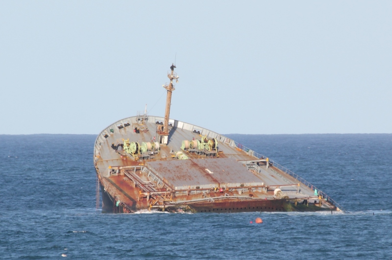
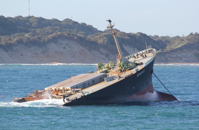
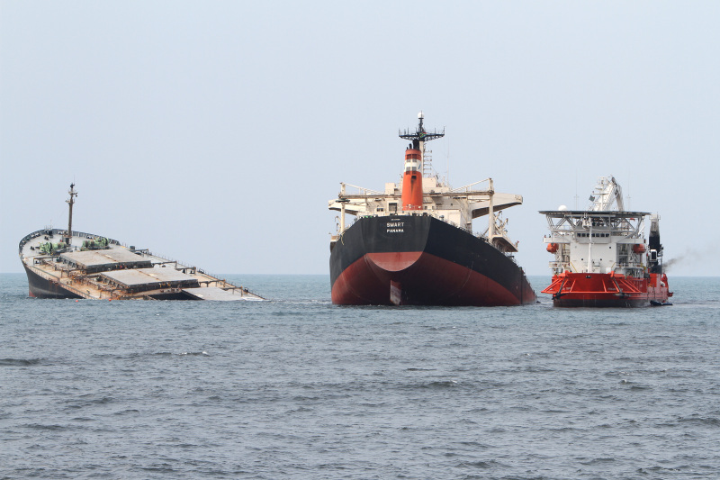
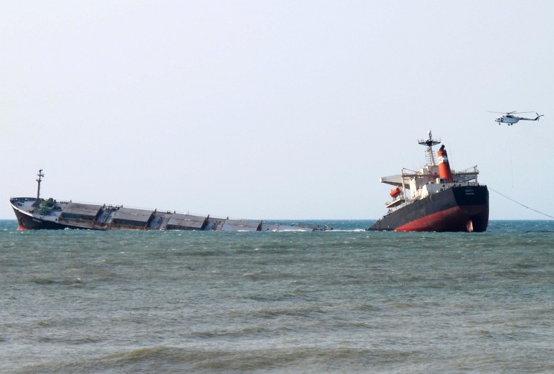
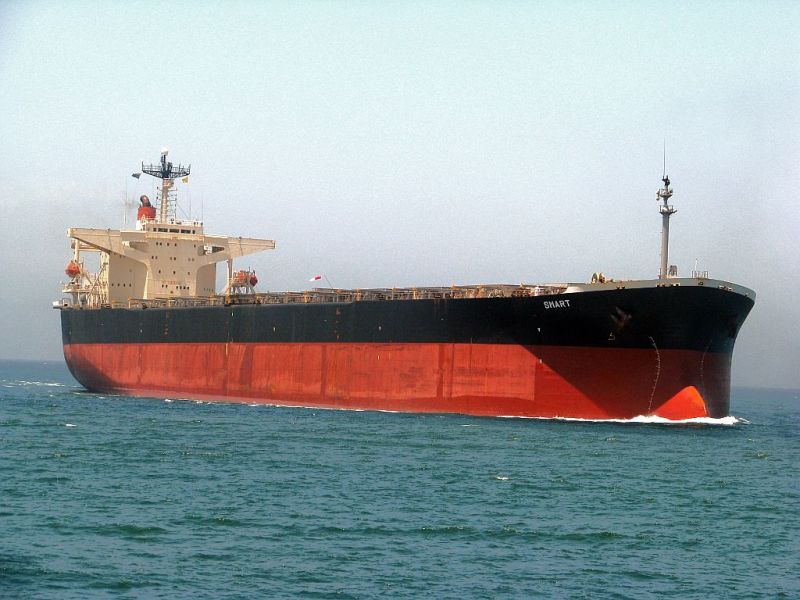
Smart - IMO 9137959

Photo
details
Photographer:Vladimir Knyaz [ View profile ]
Captured:Feb 27, 2014
Title:Smart
Location:Richards Bay, South Africa
Photo Category:Wrecks & Relics
Added:Jul 18, 2014
Views:1,229
Image Resolution:1,914 x 1,222
Description:
Vessel
particulars
IMO:9137959
Status:Dead
Build year:1996
Builder:Nkk Tsu Works - Tsu, Japan
Class society:Nippon Kaiji Kyokai
Vessel Type:Bulk Carrier
Gross tonnage:77,240 tons
Summer DWT:151,279 tons
Photos:10 photos by 7 photographers
AIS Position
of this ship
There is no AIS Position Data available for this ship!
Would you like to add AIS Coverage?
 Add AIS Coverage
Photo
Categories
This ship exists in the following categories:
Casualties - 2 photos
Wrecks & Relics - 3 photos
Bulkers built 1991-2000 - 5 photos
Photographers
of this ship
(7)
1 photos
1 photos
3 photos
2 photos
1 photos
1 photos
1 photos

COMMENT THIS PHOTO(3)
Edit
comment
Edit
comment
I repeat it here because you asked what happened?
SMART - IMO 9137959
The 273 meter long, 151279 dwt bulk freighter Smart went aground on a sandbar off Richards Bay, South Africa. The bulk freighter had finished loading its 147,650 tons of coal at the terminal at Richards Bay when left the harbour. The Smart only travelled a short distance when its engines failed. The heavy swells pushed the bulk freighter onto the shallows. The Smart suffered a massive crack and eventually broke-in-two by the following day. All 23 crew were rescued by NSRI helicopter crews. No reports of injuries.
Authorities state they are fearing the worse case scenario as the vessel had 1,500 tons of heavy fuel oil and a large quantity of diesel fuel. Some pollution has already been spotted and clean up operations have begun.
Reports state the vessel did not have a pilot on board when it left the harbour. The vessel’s owners, Esmeralda Schiffahrts, has stated that clean up operations will be covered by the company and its insurers.
YOUTUBE:
https://www.youtube.com/watch?v=keWZk9-Z2gg
https://www.youtube.com/watch?v=MkztfFrWwtc&list=UUpOxtBogqR1zBadHH1cf6rw
LOCATION: 28°48'29.9"S 32°06'29.4"E
LOOK HERE IMAGES FROM GOOGLE EARTH 2014:
https://i.ibb.co/tmjXrmT/MV-Smart-1.jpg
https://i.ibb.co/5MsKQpQ/MV-Smart-2.jpg
I hope the ADMIN and MOD UNDERSTAND!!! GREETINGS!!!
Edit
comment