®
SHIPSPOTTING.COM
WELCOME TO SHIPSPOTTING.COM
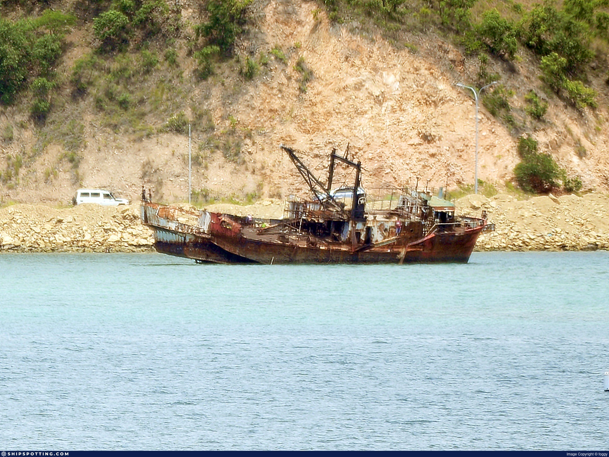
Gulf Star 2 - IMO 8515726
Photo
details
Photographer:foggy [ View profile ]
Captured:Jan 13, 2018
Title:Gulf Star 2
Location:Port Moresby, Papua New Guinea
Photo Category:Wrecks & Relics
Added:Sep 15, 2019
Views:536
Image Resolution:1,968 x 1,457
Description:
Unknown wreck at Port Moresby, Papua New Guinea
January 2018
Any info welcome
Thanks to @davidships for the identification:
GULF STAR 2 (IMO 8515726)
Vessel
particulars
Current name:GULF STAR 2
Vessel Type:Trawler
Gross tonnage:154 tons
Summer DWT:148 tons
Photos:1 photos by 1 photographers
AIS Position
of this ship
There is no AIS Position Data available for this ship!
Would you like to add AIS Coverage?

Photo
Categories
This ship exists in the following categories:
Wrecks & Relics - 1 photos
Photographers
of this ship
(1)
1 photos
More of
this ship(0)
Got photos of this ship? Upload them now!


COMMENT THIS PHOTO(4)
Niugini Dragon, Gulf Star 2, MV Gavina, Diane Dos, MV Modesta, Charter Boat, MV Fortune, FA 150, Pleasure Vessel, MV Lady Raula, MV Sunset, MV Danaya, MV Capella, MV Bougainville Atoll and MV Clouster.
https://pngresourcesonline.com/ports-corp-makes-wreck-removal-request/
My money is on GULF STAR 2 (IMO 8515726)
154gt, 24.5m
built 1986 Kanmon Zosen, Shimonoseki (Yd 385)
Gulf Papua Fisheries Pty Ltd, Port Moresby
Small pic of sister GULF STAR 1 at
https://www.destinationpng.com/section-3/gulf-papua-fisheries/
Edit
comment
Edit
comment
The vessel nearer to shore bears a registration of PNG 346, and the remains of a two word name can be seen welded at the bow. The second word is certainly DRAGON, and the first may end with an "N." If I had to guess, I'd say the vessel looks Japanese-built.
Edit
comment
There is also a video at https://www.gettyimages.no/detail/video/orbiting-drone-shot-of-shipwreck-in-port-moresby-stock-footage/1086718344?adppopup=true
The wrecks appeared on Google Earth since somewhere between November and December 2012. So far, I was not able to find any name for these ships.
Edit
comment