Advanced Search
Search

Northern Lurnes - IMO 9150535

< Previous PhotoNext Photo >
Ship
5045
FavoriteComment
More
Full Screen
Exfir Data
Download Photo

Photo
details

Photographer:
Michael Neidig [ View profile ]
Captured:
Sep 8, 1997
Added:
Jul 24, 2021
Views:
504
Image Resolution:
2,809 x 1,860

Description:

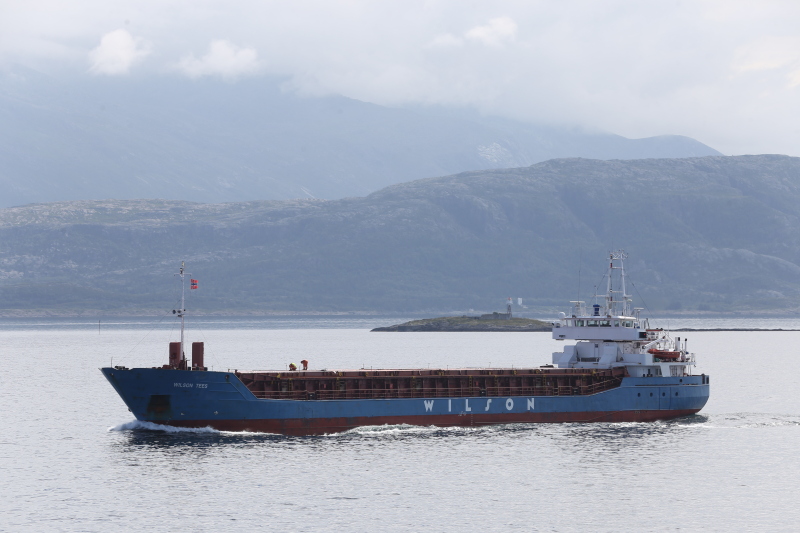
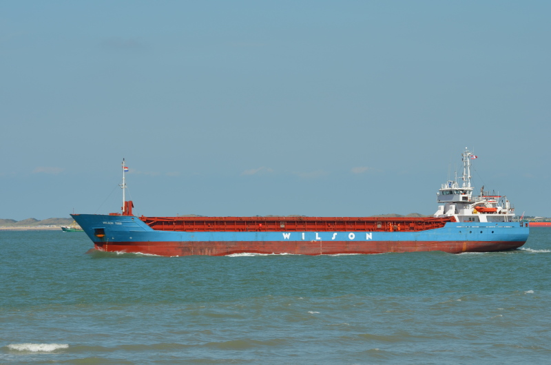
Aussenhafen Duisburg

Vessel
particulars

Current name:
WILSON TEES

Former name(s):

 -  Northern Lurnes (Until 2002 May)

Current flag:
Barbados
Home port:
Bridgetown
Vessel Type:
General Cargo
Gross tonnage:
2,446 tons
Summer DWT:
3,695 tons
Length:
87.9 m
Beam:
12.8 m
Draught:
5.5 m

AIS Position
of this ship

Last known position:
54°5’38.93” N, 6°15’4.09” W
Status:
Speed, course (heading):
5.5kts, 310.3° (310°)
Destination:
 - Location:
Warrenpoint
 - Arrival:
21st Jun 2024 / 19:00:34 UTC
Last update:
about 17 hours ago
Source:
AIS (ShipXplorer)

Photo
Categories

This ship exists in the following categories:

General cargo ships built 1990-1999 (Under 3000gt) - 173 photos

Photographers
of this ship

(76)

Tomas Pinas

1 photos

Ken Smith

3 photos

Allan Mears

1 photos

Pilot Frans

4 photos

simonwp

1 photos

Frits Olinga

2 photos

PWR

1 photos

John Jones

1 photos

Mick Warrick

1 photos

Alf van Beem

3 photos

Ulf Kornfeld

1 photos

Tomas

5 photos

Eddie Walker

1 photos

frederik

1 photos

OceanAnsi

1 photos

Christiansen

1 photos

Moolen

5 photos

Mats Brevik

2 photos

Derek

1 photos

Henk Guddee

4 photos

Hein

1 photos

sisko111

2 photos

Olaf Kuhnke

1 photos

Colwyn Grace

1 photos

Jens Boldt

3 photos

Bj

1 photos

jens smit

6 photos

Pier Master

1 photos

deleuze

2 photos

b47b56

1 photos

Stan Laundon

2 photos

Gena Anfimov

1 photos

Perseefonee

1 photos

juandofer

6 photos

G.GYSSELS

2 photos

bobjak

6 photos

vazee

1 photos

sectshun8

2 photos

Marcus-S

2 photos

Machi

2 photos

jeffess

1 photos

COMMENT THIS PHOTO(5)

Newest First
person
Danke Manfred. Die Position ist korrekt und ich kann den Binnentanker sehen.

Edit
comment

person
@MattB:
Correct location you named, this is the view in the other direction of Aussenhafen with the bulk terminal on the right:
https://www.google.de/maps/@51.4331346,6.7532927,3a,49.2y,258.01h,89.67t/data=!3m6!1e1!3m4!1sBwSp9pXBSBQ39IngD65asA!2e0!7i13312!8i6656

Edit
comment

person
That's German engineering at it's finest. I've also just looked on Google Maps to see if I can locate that exact point to no avail. There's a name 'Zollhafen Duisburg' near the Heinrich Harbisch Schiffswerft and I can see what looks like an Inland Tanker. Is that a functioning vessel because it looks like it's in a permanent position.

Edit
comment

person
I think you´re right, Matt. There is´nt any lock holding back high water from the Rhine.

Edit
comment

person
I find this an interesting photo. That's an unusual quayside. No doubt designed to mitigate flooding I would presume

Edit
comment